
Architectural Photomontage


At GENENSE, we integrate proposed developments into real environments using 3D photomontage technology. Our visualisations combine authentic photography with computer-generated architecture, helping planners, architects, and developers secure approvals faster through transparent, accurate representations.
We transform planning challenges into compelling visual stories. By merging precise architectural models with site photography, we create verification-ready views that planning committees trust, reducing consultation periods and demonstrating genuine design intent without misleading presentations.


Who Can Benefit From
3D Photomontage Rendering Services?


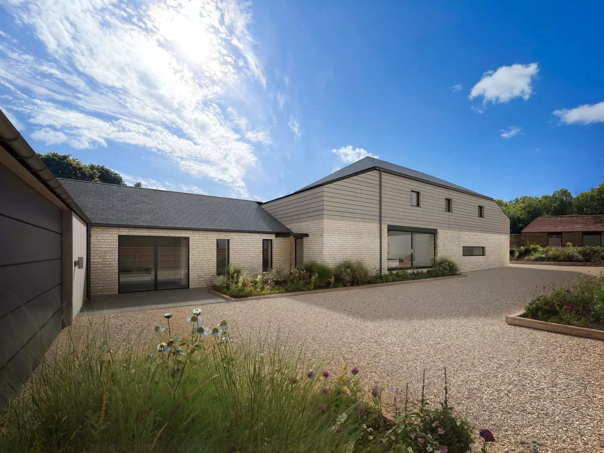
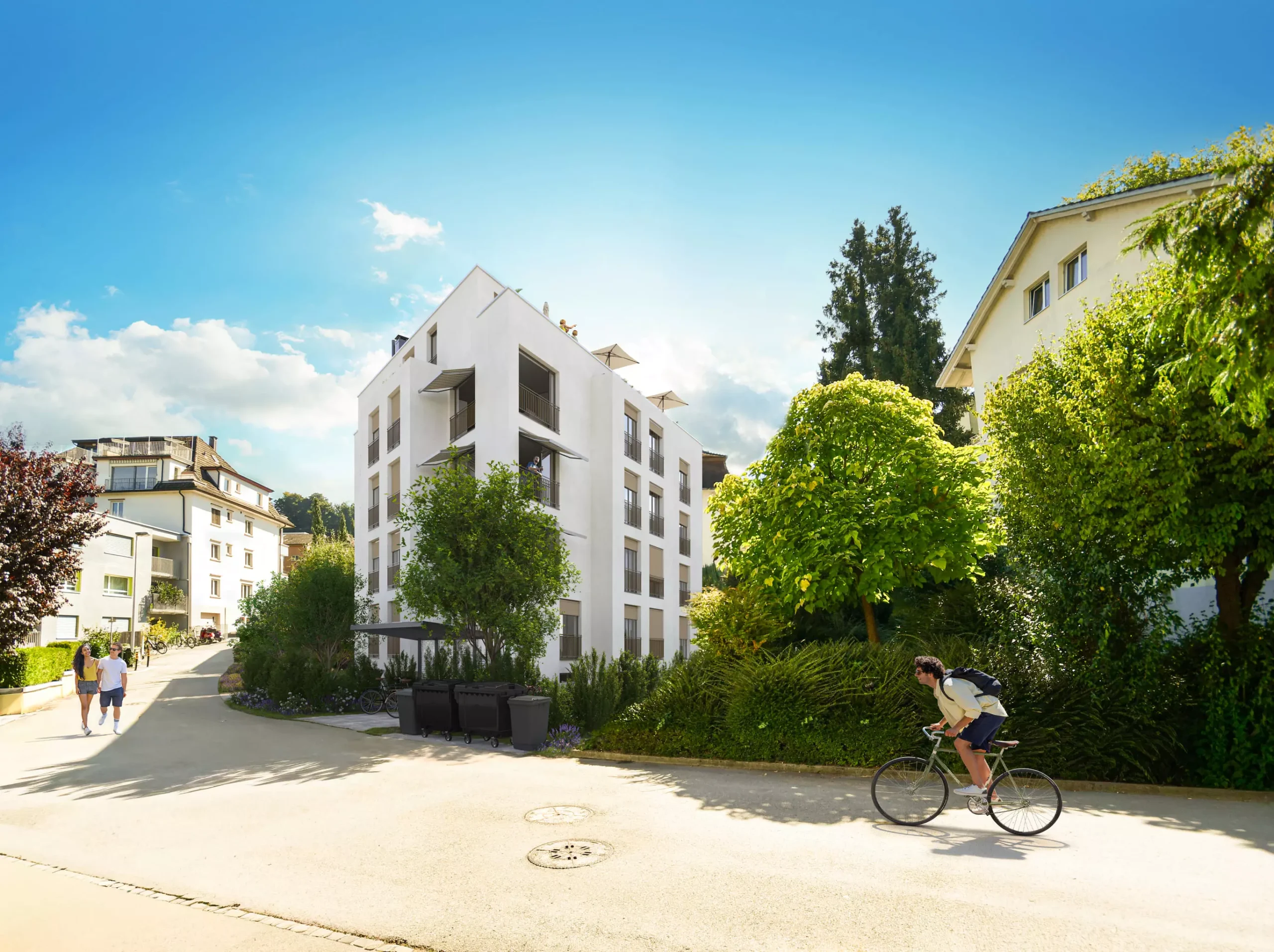
Our portfolio of architectural photomontages demonstrates consistent excellence across diverse project types and planning contexts. From sensitive heritage sites to bold contemporary developments, each visualisation showcases our ability to balance technical precision with compelling visual storytelling that resonates with all stakeholders.
Explore our recent work to discover how professional photomontage transforms complex planning challenges into successful approvals. Every project reflects our commitment to accuracy, quality, and strategic visual communication that helps clients achieve their development goals while respecting community concerns.


Founder of Genense
What is 3D Photomontage Rendering?
Photomontage rendering integrates computer-generated buildings into real photographs, showing proposed developments within authentic contexts. Unlike standalone 3D renders existing in isolation, photomontages demonstrate precise relationships between new construction and existing surroundings—crucial information for planning applications where authorities must assess actual visual impact.
This technique requires both technical skill and artistic judgment. Our specialists match lighting conditions, atmospheric effects, and colour grading between photographic and rendered elements. Shadows naturally cross existing pavements, reflections appear in neighbouring windows, and materials weather appropriately. These details create images that feel genuine rather than digitally manipulated, building confidence that visualisations represent authentic outcomes.
Accuracy standards for planning submissions demand rigorous methodology. Camera positions must align with surveyed coordinates, lens parameters require precise documentation, and viewing angles need verification against site measurements. We maintain detailed audit trails for every image, providing technical appendices intended to meet planning officers’ verification requirements. This transparency proves essential—planning decisions depend on trust.
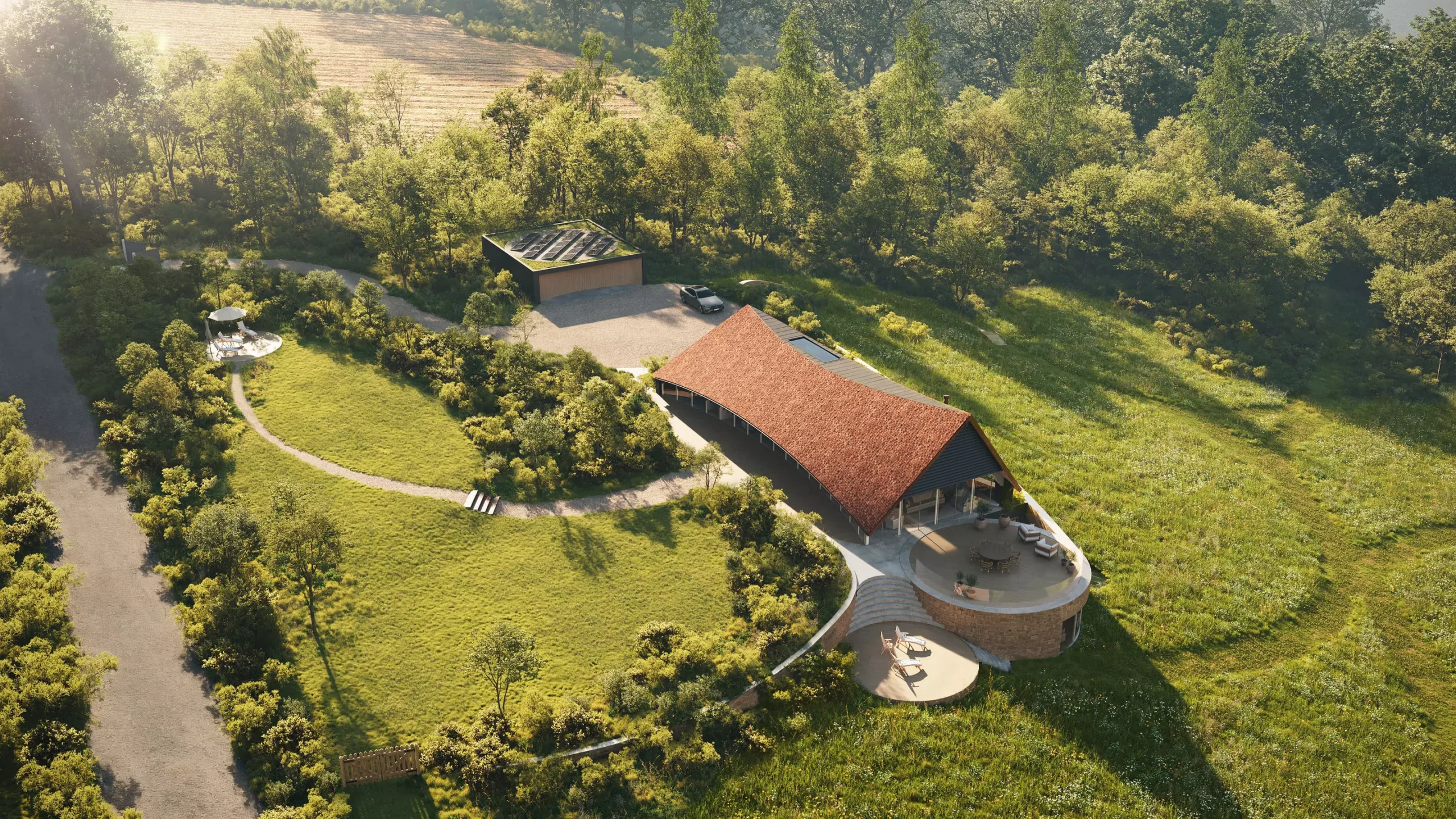
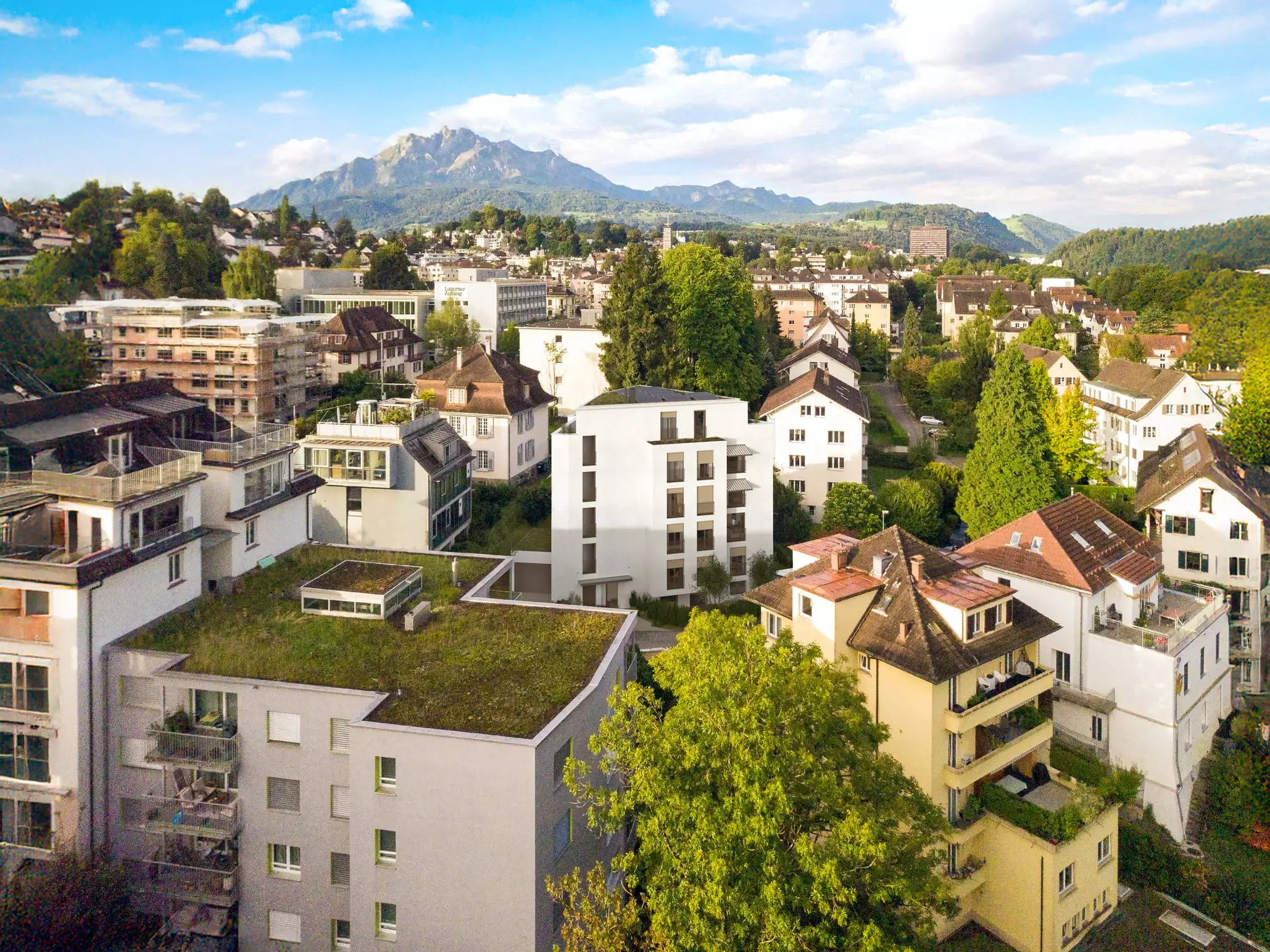
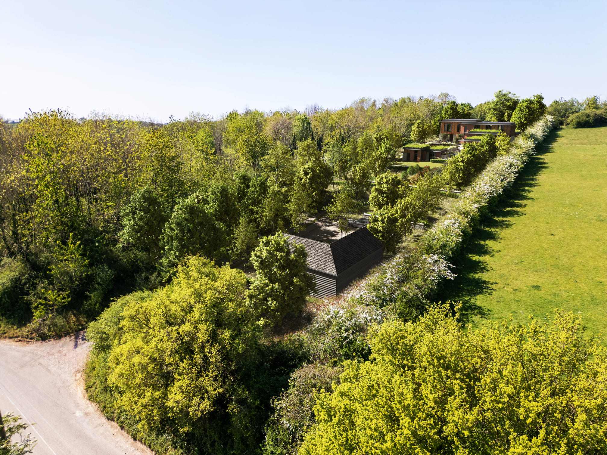
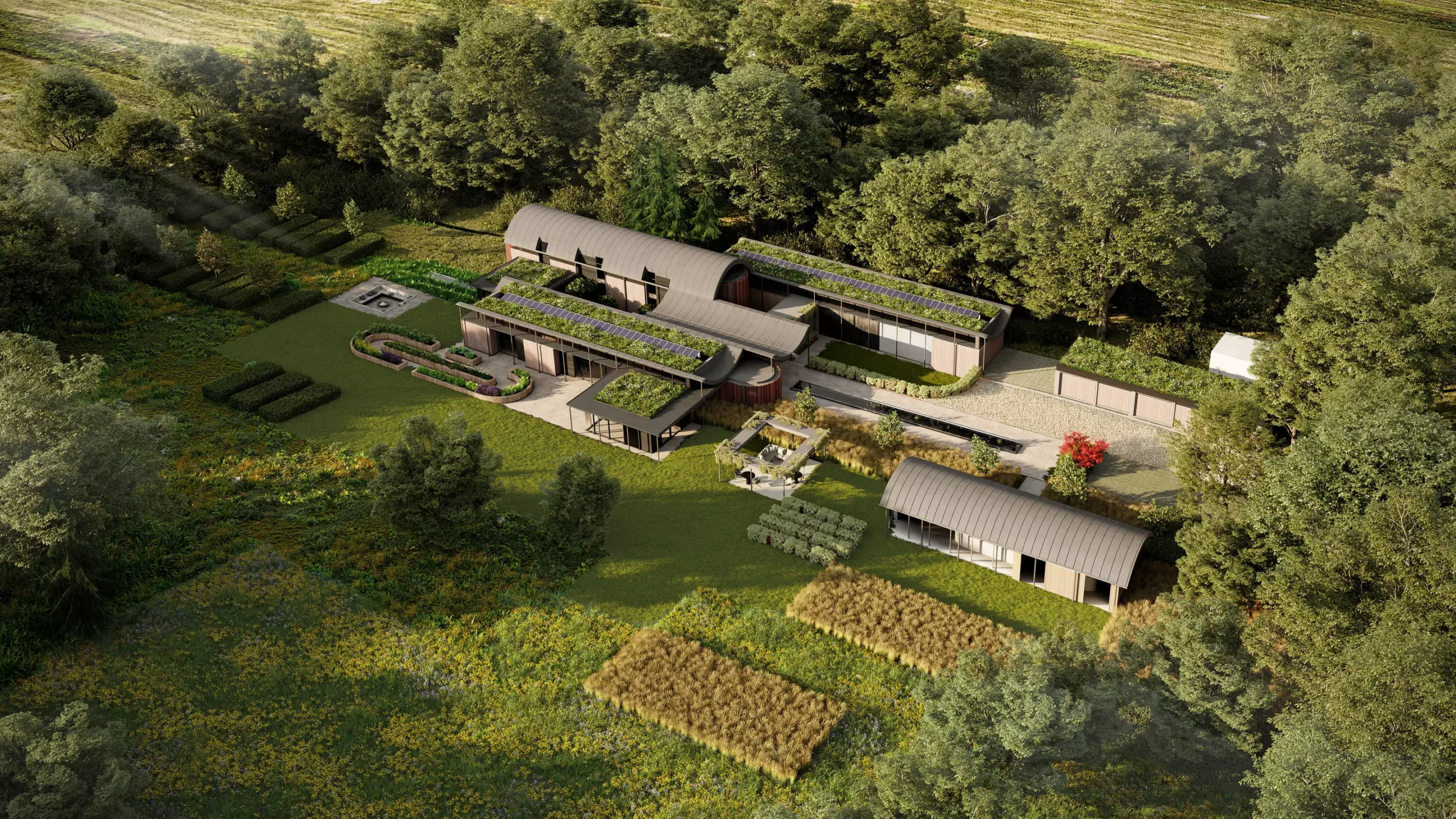
Aerial View Rendering
Aerial photomontage provides perspectives that ground-level views cannot capture, revealing how developments relate to wider urban fabric and landscape features. These elevated viewpoints are often essential for tall buildings, master plans, and infrastructure projects where overall massing matters as much as street-level appearance. Planning committees particularly value 3D aerial view rendering services for understanding cumulative impact when multiple developments proceed simultaneously.
Our aerial view rendering designers utilise drone photography, helicopter surveys, and satellite imagery, establishing accurate base contexts. We match proposed buildings to topographical data, ensuring correct elevation relationships with surrounding terrain. This precision becomes critical for hilltop developments, coastal sites, and locations near airports where height restrictions apply. Where applicable, aerial renders are verified against authoritative mapping and LiDAR datasets, such as the Ordnance Survey in the UK.
Technical challenges increase with elevated perspectives—atmospheric haze affects colour accuracy and seasonal variations change landscape appearance. Our designers account for these variables, producing images representing typical viewing conditions rather than exceptional circumstances. Where required, we calculate visibility distances using meteorological data, apply appropriate atmospheric perspective, and adjust vegetation to match specified seasons. Rendering an architectural aerial view requires this level of environmental consideration.
Site Plan Rendering
Site plan visualisations turn technical drawings into clear images. They show spatial relationships, landscape strategies, and how development phases work. Traditional plans struggle to communicate these ideas—overhead views make them obvious.
We add realistic textures, shadows, and surrounding context to create engaging site plans that still meet technical standards. Buildings sit on accurate footprints, trees cast real shadows, and materials look right. This 3D quality helps viewers understand level changes, building heights, and how spaces relate to each other—things flat drawings hide.
We use colour coding to distinguish different uses, phases, or ownership areas without losing visual appeal. Most importantly, we show how developments fit into the existing neighbourhood. We include neighbouring buildings, landscape features, and infrastructure connections. This approach works especially well for regeneration projects where new ideas must respect what’s already there while bringing positive change.
Architectural 3D Photomontage Rendering Company
GENENSE delivers architectural photomontage solutions that meet planning requirements and present projects convincingly. Our team balances technical accuracy with creative design, producing images that satisfy regulations and work for marketing. We know approvals depend on both truthful data and visual quality. Misleading presentations erode trust, whereas robust documentation helps to build it.
Our 3D photomontage rendering services use multiple verification stages. We start with site photos taken from precise GPS locations. Then we correct perspective and scale everything to match reality. This approach sets us apart from simple renders that prioritise beauty over accuracy.
We document everything: camera angles, lens specifications, verification methods. This transparency proves our realistic architectural photomontage service shows real conditions, not advertising fantasies. Properties using our visualisations get approved more often because stakeholders see exactly what they’re evaluating.
Industries We Work With
Architects. Architectural practices leverage our expertise in communicating design intent clearly during planning negotiations and public consultations. We help demonstrate how proposals enhance existing contexts, addressing concerns about scale and architectural character before they become objections. Our visualisations support competition entries, planning submissions, and client presentations, providing consistent visual language throughout project stages.
Property Developers. Developers use our renders to secure planning permissions, attract investment, and market schemes effectively. We understand the commercial pressures on development timelines and deliver visualisations that can accelerate approvals while building positive stakeholder relationships. Our photomontages help demonstrate economic benefits, regeneration potential, and community value transforming opposition into support.
Real Estate Agencies. Estate agents differentiate off-plan properties using photomontages showing exact views from future apartments and precise relationships with local amenities. Our visualisations help agencies achieve pre-construction sales by providing buyers with investment confidence.
Urban Planners. Planning consultancies strengthen policy documents and masterplan proposals with visualisations communicating strategic vision effectively. We help planners demonstrate cumulative development impact, infrastructure improvements, and public realm enhancements that technical drawings cannot convey. Our photomontages facilitate stakeholder engagement, making complex planning concepts accessible to diverse audiences.
Marketing Teams. Marketing professionals maximise campaign impact using photomontages telling compelling development stories across multiple channels. We provide consistent visual assets that work equally well in planning documents, sales brochures, and digital campaigns. Our renders support PR initiatives, community engagement, and investor communications, maintaining message consistency whilst adapting to different audience needs.
Why Choose GENENSE for Architectural Photomontage
Technical excellence underpins every project we deliver, with quality management systems ensuring consistent standards across all outputs. We work with chartered surveyors to verify dimensional accuracy, alongside professional photographers and certified visualisation artists who create photorealistic renders. This multidisciplinary expertise produces photomontages satisfying planning requirements whilst exceeding aesthetic expectations.
Client collaboration drives our process, with regular communication ensuring projects align with evolving requirements. We provide progress updates at key milestones, incorporating feedback efficiently without compromising deadlines. Our project management systems track revisions, maintain version control, and ensure smooth information exchange. This organised approach reduces stress during demanding planning periods, letting clients focus on strategic decisions whilst we handle technical execution.
FAQ
Architectural photomontage integrates computer-generated buildings into real photographs, showing proposed developments within existing contexts. Standard 3D rendering creates entirely digital scenes without photographic elements. Photomontages are often critical for planning applications, as they can demonstrate actual visual impact on real locations. Many authorities require or expect this contextual accuracy to assess how developments affect specific views, heritage assets, and residential amenity. Standalone renders work well for marketing idealised visions, but lack the documentary precision that planning decisions demand.
Essential information includes architectural drawings (plans, elevations, sections), site boundaries from topographical surveys, and specific viewpoint locations requiring assessment. We need DWG or similar CAD files showing accurate dimensions and levels, plus any 3D models you've already developed. High-resolution photographs are essential to ensure accurate representation of existing conditions and context. Material specifications help achieve a realistic appearance—provide samples, manufacturer references, or RAL colours where possible. Planning officers often specify exact viewpoint locations through site visit notes or consultation feedback. If undefined, we recommend positions based on the visual impact assessment methodology. Landscape proposals, lighting strategies, and contextual constraints (conservation areas) influence our approach.
Duration of completing a 3D photomontage depends on viewpoints, 3D model readiness and complexity, and whether professional site or drone photography is required. Verification requirements for submissions, complex scenarios like night renders or extensive glazing reflections, and dense historic contexts influence timelines. Additional time may be needed for stakeholder sign-offs, brief changes, and material clarifications. On average, the production of a 3D architectural photomontage takes around two weeks, though the exact schedule varies depending on project scope and required deliverables. Tell us about your project specifics, and we’ll provide indicative timeframes tailored to your requirements.
Pricing depends on viewpoint quantity, model complexity, and context (heritage settings, dense urban fabric), professional site photography requirements, verification levels for submissions, and turnaround speed. Output quality requirements (web versus print), revision round quantities, aerial or night scenes, and additional materials like animation or interactive assets influence final fees. For an accurate quotation, provide drawings or CAD files, viewpoint lists, material and façade specifications, style references, and site photographs.
